Imagine a pipeline integrity engineer opening a newly received inspection workbook. It has several sheets, unfamiliar headings and data that does not quite line up with the last file. The questions are immediate: which columns describe the same concepts, which records belong to which assets, and when can this information be trusted in a review?
That moment is where spatial intelligence begins. A map can make engineering data easier to understand, but it cannot repair inconsistent source material on its own. The first job is to turn a file designed for one context into records that can be understood, checked and connected to the infrastructure they describe.
An inspection file becomes useful through a visible sequence of upload, interpretation, processing and review.
The file is only the starting point

The energy-industry SaaS platform treats inspection files as source material, not finished engineering records. The Angular workspace gives the engineer a place to begin, while the Ingest service stores the upload in Azure Blob Storage and starts the processing workflow. Retaining the original matters: it keeps a reference to the evidence from which later records were produced.
The useful work begins when the engineer interprets the file. One supplier may call a field defect depth; another may split it across different columns or sheets. The workflow exposes available columns and lets the engineer select the mapping that makes the source understandable to the application.
Mapping turns variation into a usable structure
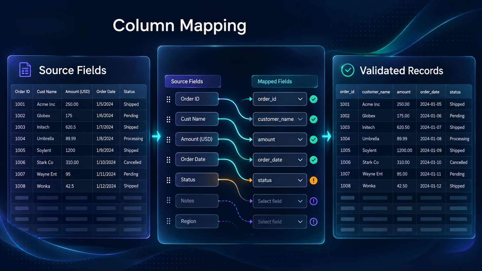
Column mapping is the point where a spreadsheet becomes a candidate for connected use. After the mapping is selected, Ingest processes the stored file and persists structured records in PostgreSQL. The data layer can then expose those records, their metadata and relevant table views to the wider application.
This does not mean the file disappears into an opaque pipeline. The user interface reports whether an upload is pending, ready for input, processing, failed or complete. That state tells the engineer whether the system is waiting for a decision, doing work or needs attention.
Spatial context comes after data context
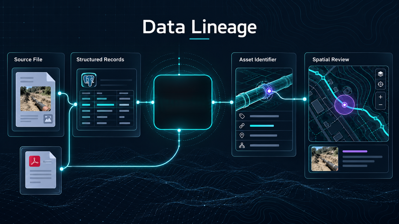
Once information has a consistent structure, mapping workflows can place it alongside pipeline assets and geographic location. A record stops being only a row in a workbook. It can become part of a review in which an engineer considers where the finding sits, what asset it relates to and which supporting information should be consulted.
The distinction is important. The AIMS does not claim that a map automatically makes data reliable. A map-based review depends on the identifiers, mappings and lineage that connect a displayed record back to its source. The platform therefore needs the file, the processed records and the relationship between them to remain visible.
What this design makes possible
The architecture supports a practical progression: source file, interpreted fields, structured records and geographic review. It makes it easier for a team to move beyond isolated spreadsheets without losing the evidence that gave the data meaning in the first place.
That same lineage can provide a foundation for future analysis-ready datasets, including a medallion-style data architecture or carefully governed AI-assisted retrieval. Their value would depend on continued validation, traceability and engineering review.